
Runway orientation, obstacle surfaces and obstacle checking in one workflow.
AeroPlanIQ takes a runway from wind data to a checked obstacle assessment: it finds the best orientation, builds the full ICAO Annex 14 obstacle limitation surfaces from the runway class, and tests every obstacle against the combined 3D limiting surface.
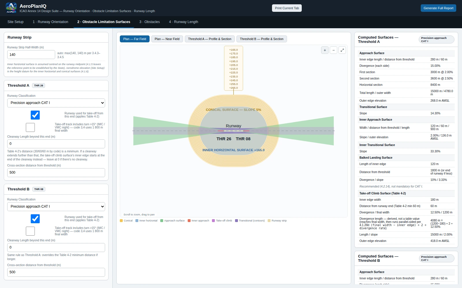
Built around the runway, the surfaces and the obstacles.
Site set-up from coordinates or a DXF
Define the runway by coordinates (XY or lat/long), length, bearing, designations and threshold elevations, or import it straight from a site DXF. The runway centreline is read from layer RWY-CL (a 3D polyline also brings the surveyed elevation profile), and obstacle footprints from layers OBS1, OBS2 and so on.
An AutoCAD helper that puts entities on the right layers
Export AeroPlanLayers.lsp, pick the runway centreline and obstacle outlines in AutoCAD, and the command places them on the correct layers, ready to import — with an explanation inside the app.
Runway orientation from the wind rose
Wind-rose analysis from sector tables, CSV import or equal sectors. It finds the best orientation, the wind coverage against the crosswind limit (set automatically from the reference field length and braking conditions) and the runway designators.
Full ICAO Annex 14 obstacle limitation surfaces
Approach, inner approach, transitional, inner transitional, take-off climb, inner horizontal and conical surfaces for each runway end, shown in plan view and cross-sections, with elevations that follow the real runway profile.
Every obstacle checked against the combined 3D surface
The combined surface is the lowest of all surfaces at each point, plus the runway strip itself. The whole footprint is tested — corners, boundary and interior — not just the vertices. Each obstacle reports its governing surface, surface elevation, obstacle top, margin and PENETRATES / PASS, with a profile drawing.
Required runway length for the design fleet
Standard corrections for altitude, temperature and slope, per aircraft and per direction, exported to CSV.
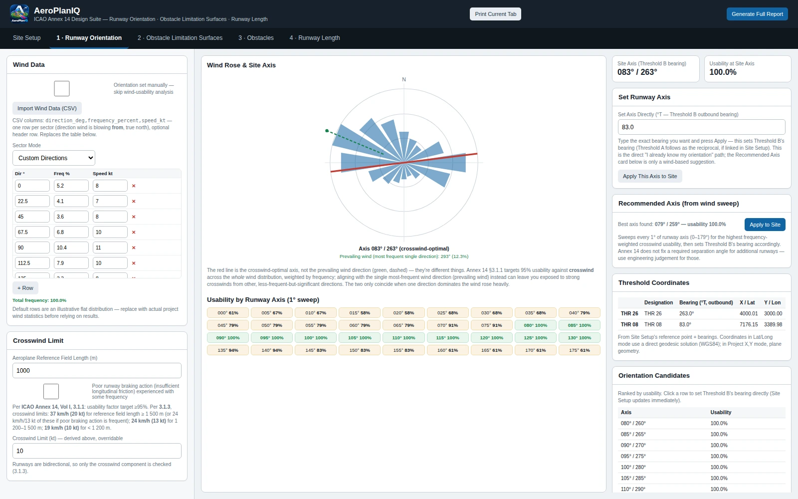
The wind rose, the best axis, and the usability behind it.
Enter wind sectors, import a CSV, or use equal sectors. AeroPlanIQ ranks candidate axes by wind usability against the crosswind limit and shows how each runway end performs, so the orientation is a result you can defend.
- Crosswind limit set automatically from the reference field length
- Usability by runway axis, with a recommended axis from the wind sweep
- Designators derived from the chosen bearing
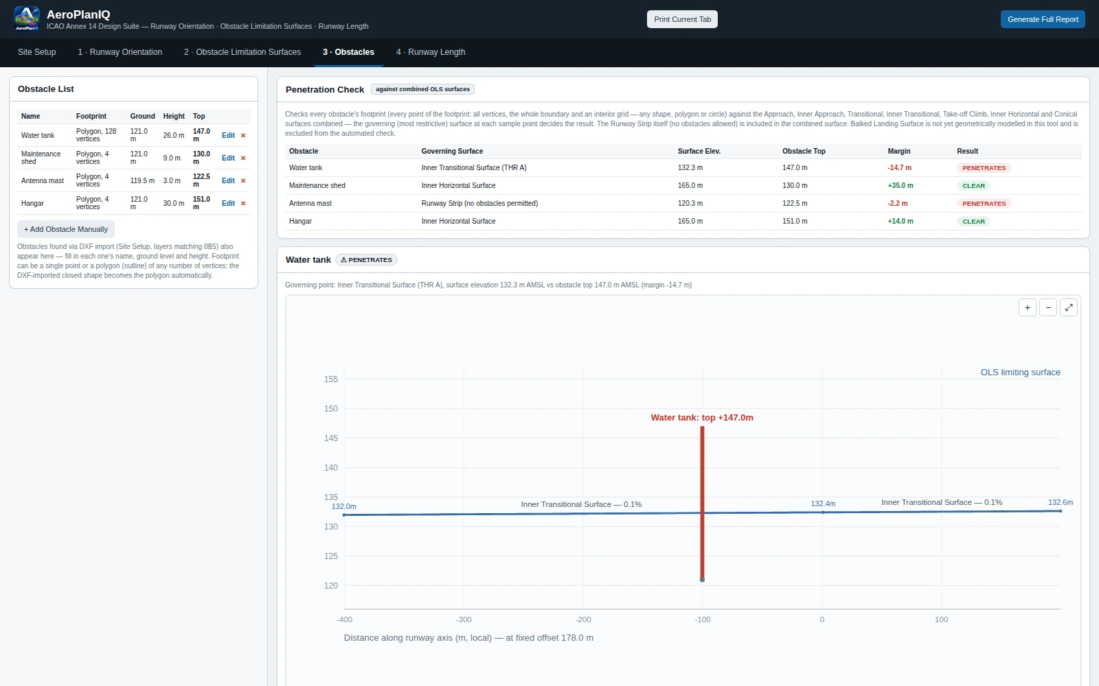
Every obstacle tested against the lowest surface at each point.
Each obstacle is checked against the combined 3D limiting surface and the runway strip, and the result names the governing surface, the margin and a PASS or PENETRATES verdict — with a profile drawing of the obstacle against the surface.
- The whole footprint is tested, not just the vertices
- Governing surface, surface elevation, obstacle top and margin per obstacle
- Profile along the runway axis at the obstacle's offset
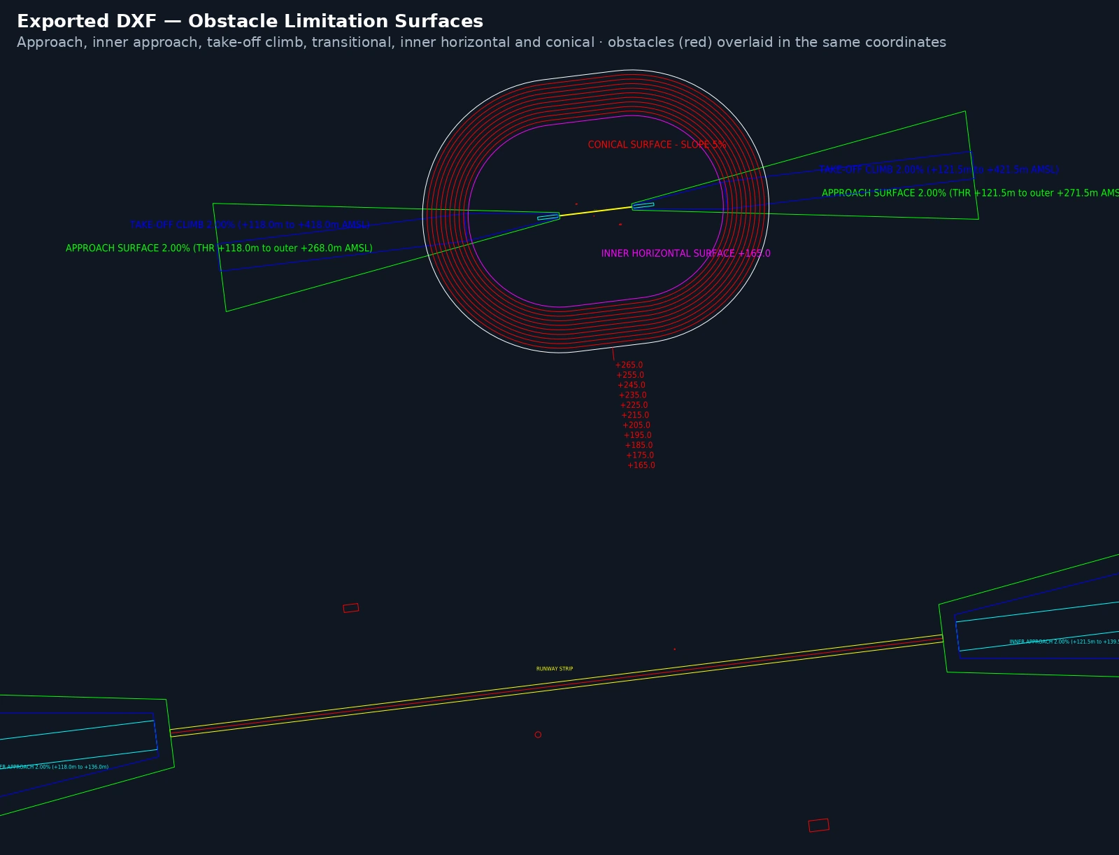
A checked runway plan, not just a drawing.
Everything the calculation produces can leave the tool in a form you can use straight away.
- A full design report to print or save as PDF
- DXF export of the obstacle limitation surfaces for use in CAD
- Runway-length results per aircraft and direction as CSV
- Work is kept if the page is reloaded
Watch a runway planned from site data to obstacle results.
Runs in the browser. Nothing to install.
Server-side calculation engine
The design logic runs on the server, so there is nothing to install and the calculation engine stays protected.
Secure sign-in with an emailed one-time code
No passwords to manage. Enter your email, receive a six-digit code, and sign in. Not sure yet? Start with a 3-day pass.
Standards-referenced, printable results
Every result cites the standard it follows and feeds a design report you can print or save as PDF.
Run your own runway and obstacle survey through AeroPlanIQ.
Try it with a 3-day pass, or request a demonstration and bring your site DXF and wind data.